https://www.boonray.com/en/data/upload/202204/20220416094047_441.jpg
Boonray i-fly System
Autonomous Flight, Intelligent Decision-making

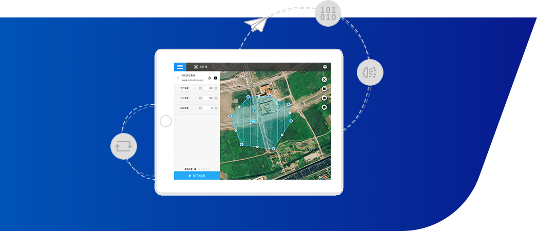
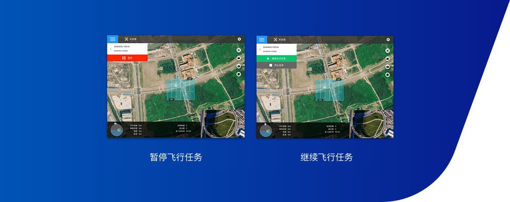
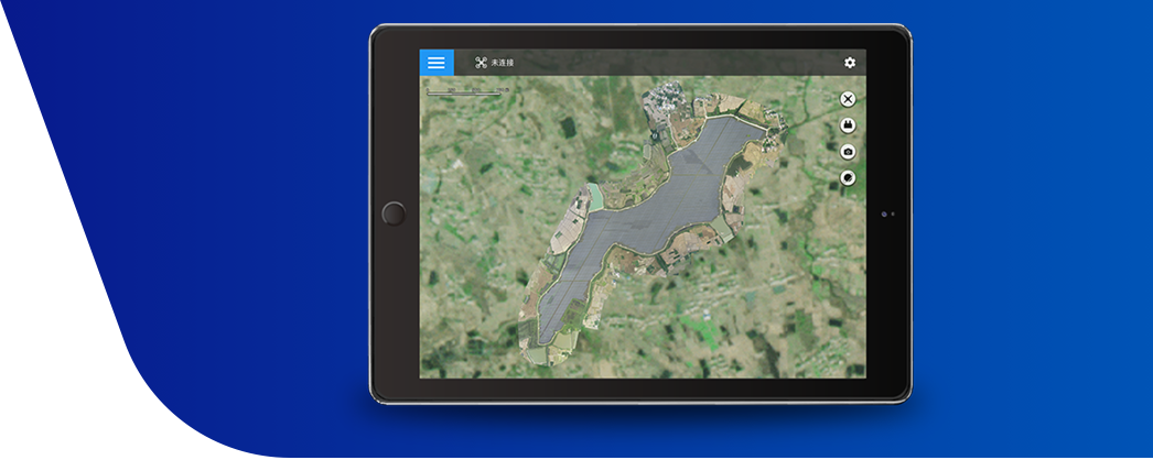
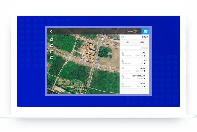
The system includes an automatic flight algorithm independently developed by Boonray, an airborne sensing control unit, ground station software, and a cloud task management system.

The system collects the geographic data and performs quantitative analysis on the indicators to make the flight routes more scientific and can meet the needs of complex tasks and emergency tasks.

  • Intelligent collaboration
  • Autonomous operation
  • Digital control
  • Automatic Flight Algorithm

  • Airborne Sensing Control Unit

  • Ground Control

  • Cloud-based Mission Management System

  • Automatic Flight Algorithm

    Accurate and reliable automatic flight algorithm can realize multi-terrain, all-round environment perception and centimeter-level high-precision positioning. And it intelligently recognizes various objects, defects, and emergencies, and provides highly reliable decision-making suggestions.

  • Autonomous Flight Planning

  • High-precision Positioning of VGIN

  • Intelligent Identification

  • High-precision Flight Control

  • Airborne Sensing Control Unit

    Curie III

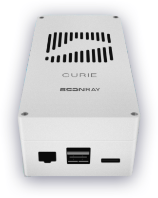
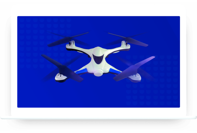
    Curie Ⅲ has the power of deep neural networks to conduct image processing. It can carry out real-time detection and recognition of objects. Using IMU and camera, vision-based SLAM are established, enhancing the positioning accuracy of the flight platform. It integrates with the 4G module, thus enabling bi-directional communication with Boonray Cloud and hence fully automates the flight control of the drone, along with real-time data transmission from the drone to the platform. The flight data includes processed video stream ready for high definition broadcast. Typical applications include security monitoring systems such as human traffic monitoring in public spaces and vehicle traffic monitoring on roads.

  • Voltage: 12V
  • CPU: A57
  • GPU: Pascal
  • Ram: 8GB DRAM
  • Internal Storage: 32G
  • Ground Software
  • Flight Route Planning

    Boonray i-Flight has realized the digitalization and automation of drone flight route. The days of manual route planning are long gone. Boonray flight collects geographic data from relevant routes and analyzes them quantitively, making flights more secure and accurate. Flight missions can then be more complicated; even emergency response missions are possible.
  • Setting of Flight Area

    Many shape selections (polygon, rectangle, circle, line) are available, covering different types of photography scenarios, from orthophotography to 3D modelling. Flight planning becomes more accurate and convenient.
  • Flight Route Continuation

    Flight mission can be paused anytime, records will be saved such that the user can always resume the mission from where they left off. Settings can be personalized, with practicality in mind, to provide a pleasant flight experience.
  • Base Map Settings

    Using 2D maps synthesis functions, an aerial map of the target area be formed quickly and efficiently. Users only need to complete the aerial photography of a target area. Afterwhich, the user simply import the images into the software for processing to form the complete 2D map of the target area. At the same time, users can make edits and improvements to the final result, to create an even more realistic environment.
  • Cloud Task Management System
  • Cloud to Client Side Interconnection

    There are many types (polygon, rectangle, circle, waypoint) to choose from, it is suitable for the flight requirements of different shooting scenes such as orthophotos and 3D. It has a wider range of use, stronger adaptability, and more accurate and convenient route drawing.
  • Account Control

    There are many types (polygon, rectangle, circle, waypoint) to choose from, which are suitable for the flight needs of such as orthophoto and 3D, with a wider range of use, stronger adaptability, and more accurate and convenient route drawing.
  • Task List

    Boonray Zhifei saves every task, clearly display the unstarted, suspended, and completed flight tasks, and the corresponding time, to provide convenience for users to quickly view and perform flight tasks.
  • 沪ICP备17037264号-2 Copy right@2022  Shanghai Boonray Intelligent Technology Co., Ltd. all rights reserved

    Shanghai Headquarters

    Address:6th Floor, Building 4, No. 388 Shengrong Road, Zhangjiang Science City, Pudong New Area, Shanghai

    Telephone:021-58212107

    Post code:200124

    Mail:info@boonray.com